What is it about?
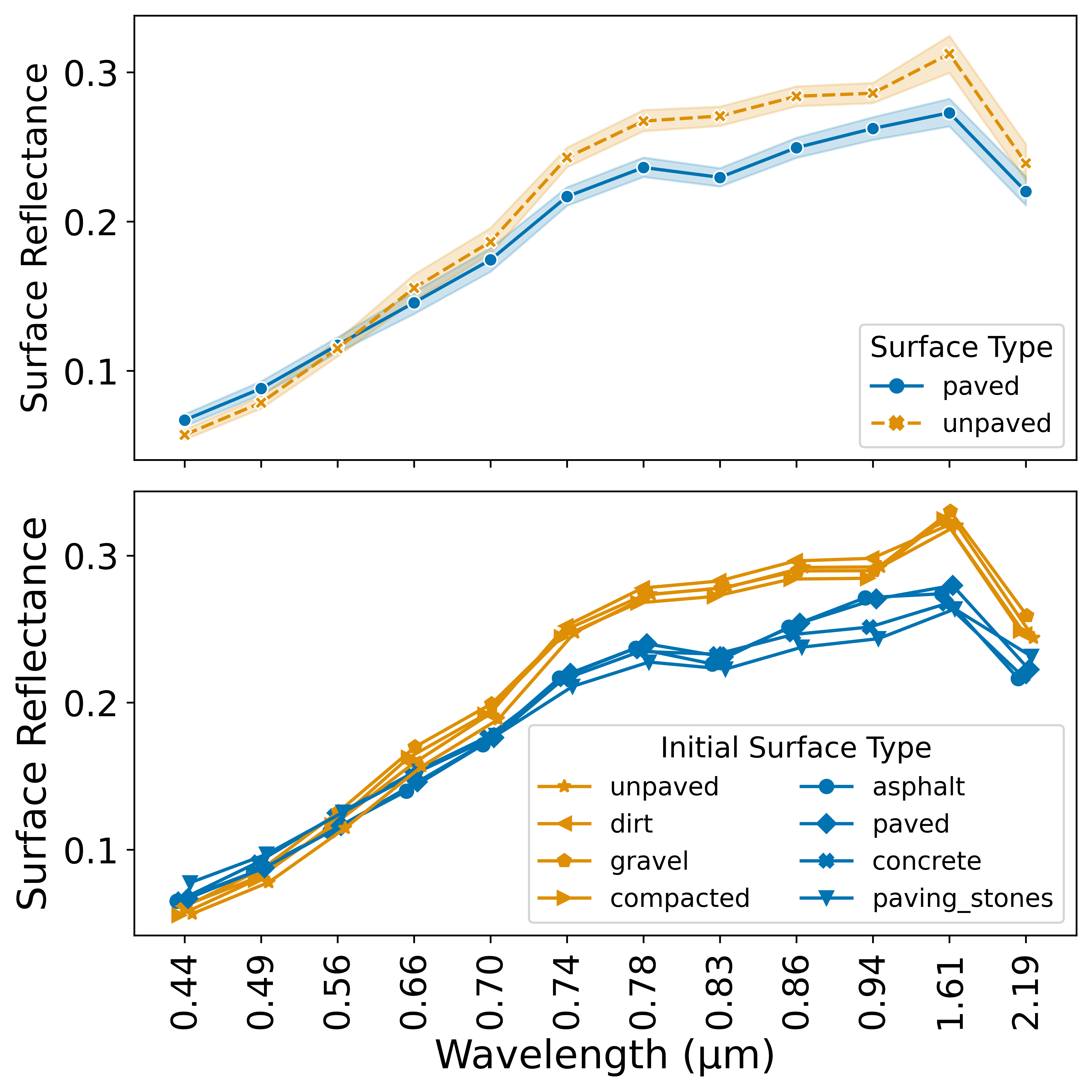
Mapping road quality is important for understanding progress in infrastructure development. We show that paved and unpaved roads are distinguishable in medium-resolution satellite imagery, especially in the higher wavelengths part of the electromagnetic spectrum. We use machine learning techniques to classify roads as paved or unpaved and devise a metric that utilizes these classifications to assess road quality.
Featured Image

Photo by John O'Nolan on Unsplash
Why is it important?
A key advantage of our approach over others in the literature for assessing road quality is that it doesn’t require high-resolution satellite images and offers greater temporal and spatial granularity.
Perspectives

The proposed approach enables the creation of multitemporal road quality maps, which serve as tools for monitoring infrastructure quality, strategically directing new investments, and evaluating the broader impacts of road development on surrounding communities.
Tunmise Raji
Rochester Institute of Technology

The approach we put forward in this paper can be very useful for work in developing countries where data is scarce. It is even more useful considering the fact that it is a low computational approach, with simple publicly available dataset.
Courage Ekoh
Rochester Institute of Technology
Read the Original
This page is a summary of: Paved with Good Reflections: Road Quality Mapping with Multispectral Satellite Imagery, October 2024, ACM (Association for Computing Machinery),
DOI: 10.1145/3671127.3698173.
You can read the full text:
Contributors
The following have contributed to this page


